Robotic aircraft have taken to the skies, finding increasing use in military applications, law enforcement, environmental monitoring, and also becoming popular among hobbyists who want to build their own drones.
These unmanned aerial vehicles, or UAVs, have varied degrees of autonomy, though typically they depend on GPS and also on supervision from a human operator, who can send commands to the aircraft and receive images from its on-board cameras.
Now researchers at McGill University's Mobile Robotics Lab, in Montreal, Canada, are making these smart aircraft a bit smarter. They've developed a UAV control system that uses aerial images to identify visual cues on the landscape and steer the aircraft autonomously.
Aerial vehicles guided by advanced vision capabilities could help track wildfires, oil spills, and even animal herds. The aircraft would carry out monitoring and mapping missions requiring no human supervision or GPS coordinates.
Anqi Xu, a PhD student, and his advisor, Professor Gregory Dudek, director of the Mobile Robotics Lab, say that their current system is capable of following a coastline or a road surrounded by forests.
The researchers presented their results at the IEEE/RSJ 2010 International Conference on Intelligent Robots and Systems in October.
They used a fixed-wing UAV called the Unicorn from Procerus Technologies, which they can control via software. The aircraft carries a gimbal-mounted camera that streams video over a radio link. A Linux notebook computer analyzes the video feed and sends heading updates to the UAV in real time.
To track coastlines, their vision algorithm analyzes the color properties in the images to distinguish between water and land. To track a highway in a wooded region, it analyzes textures cues. Once the algorithm has identified the boundaries between different areas, it then determines a heading to follow.
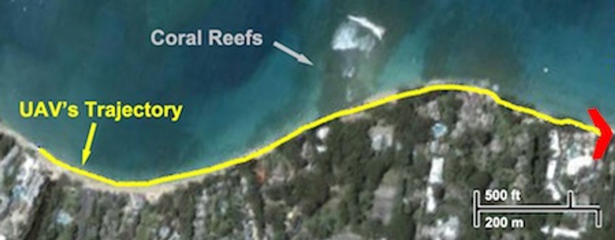
To test their system, the researchers took their UAV to the beach. Watch:
The test area consisted of a 1-kilometer long "S" shaped tropical coastline. After manually aligning their UAV, their control system took over and successfully steered the aircraft along the stretch of the shore. The UAV traveled at an altitude of 150 meters with an average ground speed of 13 meters per second with lateral wind speed of 7 meters per second.
How would that performance compare to a human operator piloting the UAV using the same visual information?
The researchers asked five volunteers to watch the recorded images and specify headings to keep the UAV following the coastline. Though there were discrepancies between the headings produced by the algorithm and by the volunteers, the researchers concluded that their system can perform nearly as well as a human operator.
In a next phase of the project, the researchers plan to use their aerial tracker to transmit navigation data to another of their systems, an amphibian robot designed to study coral reefs.
Images and video: Mobile Robotics Lab/McGill University
Erico Guizzo is the director of digital innovation at IEEE Spectrum, and cofounder of the IEEE Robots Guide, an award-winning interactive site about robotics. He oversees the operation, integration, and new feature development for all digital properties and platforms, including the Spectrum website, newsletters, CMS, editorial workflow systems, and analytics and AI tools. An IEEE Member, he is an electrical engineer by training and has a master’s degree in science writing from MIT.


