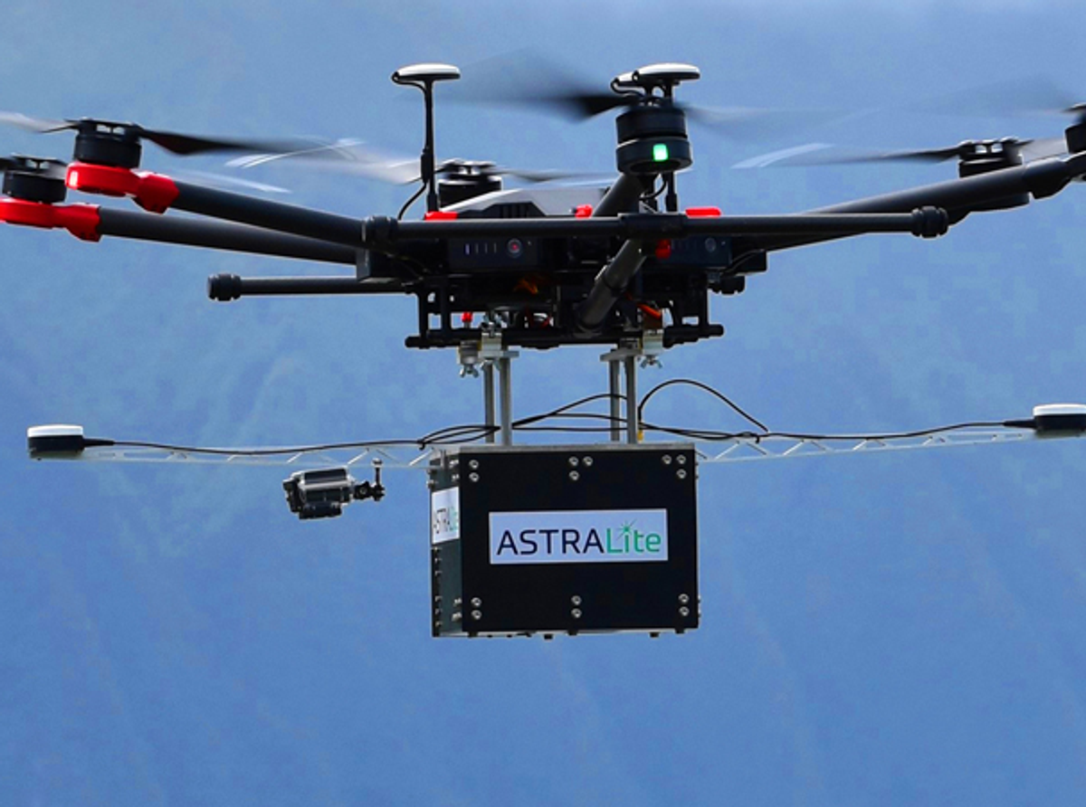
World's first small-scale topographic and bathymetric scanning LiDAR
ASTRALiTe's edge™ is the world's first small-scale topographic and bathymetric scanning LiDAR that can detect small underwater objects, measure shallow water depth, and survey critical underwater infrastructure from a small UAV platform.
The edge™ can see beneath the water surface at depths from 0-5 meters and is completely self-contained with its own Inertial Navigation System with GNSS, battery, and onboard computer. It weighs about 5 kg and is designed for deployment on UAV systems for faster, safer, and more accurate bathymetric surveys. This patented 2-in-1 topographic and bathymetric LiDAR offers a centimeter-level depth resolution. There are numerous possible applications for this LiDAR, such as coastal mapping and surveying, infrastructure inspection, or even military logistics.
Importance of geo-referencing and motion stabilization
“We needed a motion and navigation solution for our LiDAR. Our requirements included high accuracy along with low size, weight, and power" explains Andy Gisler, Director of Lidar Systems with ASTRALiTe. In addition, the system needed to be able to apply Post-Processing Kinematic (PPK) corrections to the LiDAR data to provide higher accuracy results to ASTRALiTe's customers.
The LiDAR provides a comprehensive point cloud that needs to be motion-compensated and geo-referenced to be usable. Two methods can be used to reach the centimeter-level accuracy requested by surveyors. The first one is Real-Time Kinematic (RTK), which makes use of corrections obtained from a base station or a base station network in real-time thanks to a radio or a GSM link. The second one is used after the mission using a PPK software. This software will apply the same correction as RTK, but it will also re-compute all the inertial data and raw GNSS observables with a forward-backward-merge algorithm to correct all the trajectories, fill any loss of position, and greatly improve the overall accuracy.
ASTRALiTe chose SBG Systems' dual antenna Ellipse2-D inertial navigation system which provides motion, RTK, and PPK. The weight of the INS/GNSS solution was especially important to ASTRALiTe as they were designing a system to be flown on most UAVs, where light payload capacities are required for UAV compatibility. The possibility to use two antennas was a key element to consider, as they required a robust heading even during slow-speed flights. In addition to this INS, they also use Qinertia, SBG Systems' in-house post-processing software.
This PPK software gives access to offline RTK corrections from more than 7,000 base stations located in 164 countries and is designed to help UAV integrators get the best of their GNSS or INS/GNSS solution.
About SBG Systems INS/GNSS
SBG Systems is an international company which develops Inertial Measurement Unit with embedded GNSS, from miniature to high accuracy ranges. Combined with cutting-edge calibration techniques and advanced embedded algorithms, SBG Systems manufactures inertial solutions for industrial & research projects such as unmanned vehicle control (land, marine, and aerial), antenna tracking, camera stabilization, and surveying applications.


