
Attention, greenhouse gas emitters: There’s a new eye in the sky that will soon be photographing your carbon footprint and selling the images to any and all. It’s a microsatellite dubbed Claire (clear or bright in French) by its Montreal-based developer, GHGSat.
This microwave-oven-size pollution paparazzo rocketed to a 512-kilometer-high orbit in mid-June, care of the Indian Space Research Organization, with a mission to remotely measure the plumes of carbon dioxide and methane wafting up from myriad sources on Earth’s surface. Claire’s targets include power plants, natural-gas fracking fields, rice paddies, and much more—just about any emissions source that someone with a checkbook (corporations, regulators, activists) wants tracked, according to GHGSat president Stéphane Germain.
Germain says Claire’s data can improve compliance reporting to regulators and carbon markets, enable tracking of industrial efficiency, and provide competitive intelligence, among other uses. “Our vision is to be the global standard for emissions monitoring across the world. That’s ambitious, but we think it’s attainable,” he says.
Space agencies already monitor emissions from orbit. They have launched a series of satellites such as Japan’s Ibuki mission to track atmospheric CO2 and methane, and those missions are delivering an important reality check on national pollution inventories, which are based largely on engineering estimates.
Both satellite and ground-based research have identified vast undercounting of methane emissions by the U.S. Environmental Protection Agency, prompting the agency to revise its inventories earlier this year.
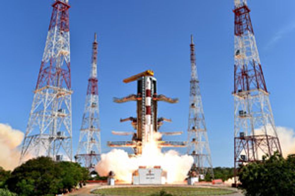 Up and Away: The Indian Space Research Organization launched Claire in June.Photo: GHGSat
However, Ibuki and other satellites such as Europe’s Tropomi and NASA’s Orbiting Carbon Observatory-2 (OCO-2) were primarily designed to generate data for climate models. They therefore emphasize a wide field and exquisite greenhouse-gas-level precision, but they have low spatial resolution. Germain says Claire is designed for a totally different mission.
“We have deliberately limited the scope of the physical field of view. We know where the emissions are coming from. All we need to do is point at known sites and characterize the plume from the facilities,” says Germain.
Like its predecessors, Claire uses an infrared spectrometer to detect telltale patterns of sunlight absorption that indicate levels of atmospheric CO2 and methane. Unlike its predecessors, which use side-to-side scanning “push-broom” spectrometers to generate a 2D spectral database, Claire has an imaging spectrometer that takes a series of 2D spectral snapshots as the microsatellite passes overhead.
Telescopic lensing focuses Claire’s spectrometer to take 12- by 12-kilometer snapshots. With its 0.25-megapixel detector, each pixel thus represents a 50- by 50-meter plot of ground—a spatial resolution two orders of magnitude greater than that of OCO-2.
GHGSat also parted ways with its predecessors on cooling. Cryogenic cooling of spectrometers reduces background noise for missions such as OCO-2. Claire does without cooling to minimize complexity and weight, helping keep total project cost including launch below C$10 million (US $7.7 million). Signal-to-noise ratio is maintained, says Germain, by combining multiple snapshots and filtering out noise.
Further data processing turns Claire’s composite images of CO2 and methane concentrations above a given site into an estimate of the rate at which gases are flowing from their source. GHGSat will do this by factoring in data on wind speed and direction, using “inverse modeling” that is analogous to methods proven by OCO-2 and Tropomi.
Some prelaunch coverage of GHGSat was skeptical of the firm’s ability to deliver. InsideClimate News wrote in June that most scientists it contacted questioned the readiness of both remote-sensing technology and inverse modeling to deliver reliable emissions estimates.
Harvard University remote-sensing expert Daniel Jacob, a GHGSat collaborator, strikes a more optimistic tone. He says that if Claire’s spectrometer can deliver the +/– 1 to 5 percent precision that GHGSat is predicting, “the ability to detect point sources will be impressive.”
Kenneth Davis, a professor of meteorology at Penn State University, says that precision is likely to be GHGSat’s biggest challenge. “It is very difficult to calibrate remote measurements, and small errors in measurements can lead to large errors in inferred emissions,” says Davis.
GHGSat expected to complete testing of Claire’s systems in July and to begin making observations for initial customers within a month or two. Up first are hydropower reservoirs in Quebec and Manitoba and large tailings ponds associated with oil-sands mining in Alberta. Estimating emissions from the latter is currently dangerous, costly, and fraught with uncertainty levels in excess of 50 percent.
Those initial sites will help GHGSat begin the calibration process. Ground measurements will be taken simultaneously at those sites to validate the satellite’s performance and tune its detectors.
Plans are already afoot, meanwhile, to launch a second satellite in 12 to 18 months to assure continuity of observations should Claire malfunction and to expand GHGSat’s customer capacity. (Claire will be able to monitor over 1,000 sites per year.)
More satellites will also enable more frequent tracking of a given site. While Claire orbits Earth every 90 minutes, its route takes it within range of the same site just once every two weeks. That could make data from one or a few satellites hard to interpret for dynamic operations, such as power plants that ramp up and down hourly or daily, or natural-gas compressor stations and fracking wells that sporadically belch large volumes of methane.
Germain says that, with sufficient demand, GHGSat may ultimately launch a fleet large enough to meet even those challenges: “It’s well within the reach of our business case to get to daily measurements, or even to two to three times per day.”