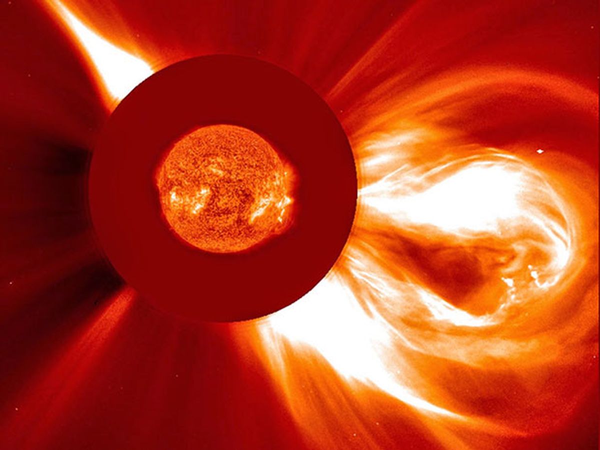
NASA relies on spacecraft to help keep watch for solar storms erupting on the sun. But on the ground, the space agency’s Solar Shield project aims to improve computer simulations that predict if those solar storms will create electrical hazards for power plants and transmission lines.
The Solar Shield project’s research efforts have focused on comparing computer simulation predictions with actual observations from ground stations. At the start of 2016, NASA announced it had added six new test sites around the United States to provide real-world data for comparison with the simulations. But researchers behind Solar Shield also plans to upgrade the computer models that simulate the physics behind the Earth’s geomagnetic processes.
“One of the big new things coming out of this project in the next few months or so will be the inclusion of a full physics, 3-D treatment of the geomagnetic induction process that drives the main hazard from solar storms,” says Antti Pulkkinen, a heliophysicist at NASA’s Goddard Space Flight Center.
Geomagnetically induced currents stem from disturbances in the Earth’s magnetic field that can create electric currents in conductive structures on the planet’s surfaces—structures such as modern power grids. Potentially damaging events can take place when a severe solar storm’s charged particles strike the Earth’s magnetic field. Such events represent rare but potentially catastrophic threats to modern society’s reliance on vulnerable power grids.
The most damaging geomagnetic event in modern history occurred when a solar storm caused widespread failures in Canada’s Hydro-Quebec power grid and blacked out six million people in 1989. That was still fairly small compared with the largest solar magnetic storm ever recorded, which struck Earth in 1859. The so-called Carrington Event of 1859 mostly took down telegraph systems and gave some telegraph operators a frightful shock. But a 2013 study by the Lloyd’s insurance market estimated that a similar event in modern times could cause up to US $2.6 trillion in damage for North America alone. In 2012, the Earth dodged a bullet when a huge solar flare that would have rivaled the Carrington Event missed striking our planet by just nine days.
The computer models now used by the National Oceanic and Atmospheric Administration (NOAA) to make solar storm forecasts rely on a simplified “one-dimensional” model of the Earth’s geomagnetic induction currents. Such 1-D models mainly calculate the Earth’s conductivity based on depth rather than geography, Pulkkinen explains. That means the models are strong in calculating changes in conductivity based on how far down you go through the Earth’s layers, but much less accurate in calculating conductivity differences that arise at different locations on the Earth’s surface.

For example, 1-D models have trouble calculating changes in geomagnetic induction currents near coastal regions where land abruptly gives way to ocean. That’s a particularly big problem because such models have trouble calculating the buildup of charge at the boundary between land and sea (also known as the “boundary effect”). The charge buildup creates its own electric field that can extend inland and potentially affect the grid infrastructure on the coast.
Pulkkinen and his colleagues hope to soon begin testing new 3-D models through the Sun Shield program as a possible replacement for the older 1-D models used by NOAA. Such 3-D models would do a much better job of accurately calculating the conductivity changes that occur based on location. They would also be able to model the “boundary effect” of the coasts for the first time.
“There is a direct relationship between the boundary effect and elevation and the current effect you experience in the geomagnetic system,” Pulkkinen explains. “As for its significance regarding the power grids, that’s yet to be decided.”
A comparison of the computer models with real-world data will help NASA figure out if the 3-D model upgrades actually deliver better results. Until recently, Solar Shield has collected current measurements from just two sites as a way of validating its computer models. But on 16 February, NASA announced that the program will use additional data from six power substations across the continental United States that are managed by the Electric Power Research Institute .
Substations typically convert power to high voltage for efficient movement across long distances on transmission lines, or they lower the voltage to levels appropriate for distribution to customers. In this case, the six additional substations contributing data to Solar Shield are involved in transmission.
If the NASA test run proves its worth, the 3-D models of geomagnetic induction currents could eventually become part of NOAA’s operational space weather forecasting. Meanwhile, NOAA is working on improving the space science side of the forecasting models, which focus more on the sun and solar storm activities in space. Taken together, the improved computer simulations may help better prepare power grid operators for solar storm events.
“From the physical standpoint, what you’re trying to capture is the interaction between the solar storms and how the solar storms modify Earth’s near-space and geological structures,” Pulkkinen says. “We’re going to be able to better quantify that in the future.”
Jeremy Hsu has been working as a science and technology journalist in New York City since 2008. He has written on subjects as diverse as supercomputing and wearable electronics for IEEE Spectrum. When he’s not trying to wrap his head around the latest quantum computing news for Spectrum, he also contributes to a variety of publications such as Scientific American, Discover, Popular Science, and others. He is a graduate of New York University’s Science, Health & Environmental Reporting Program.


