
A few weeks ago, I went home to Oregon to visit my family. On a whim, I brought along my Parrot Anafi drone—it’s small and lightweight and uses the same USB-C charger as my laptop, so it was easy to toss into my carry-on. Like you do in Oregon, our plans were to go river rafting, hiking, and kayaking, and I figured I’d pack the drone and try and find some interesting opportunities to fly it.
I try hard to be a responsible drone owner. I don’t have my U.S. Federal Aviation Administration Part 107 certificate yet, but my drone is registered and labeled, and I’m an AMA member, which includes insurance for recreational drone pilots. I also do my best to make sure that the places I fly are places that I’m allowed to fly, and fortunately, the FAA has a handy app that is supposed to make that easy.
And it would have been easy, if I didn’t bother to check whether what the app was telling me was accurate or not. But I did check, and as it turns out, the app is, in many situations, worse than useless.
Finding somewhere to legally and safely fly a drone for recreational purposes can be tricky. Most people who buy a drone to fly recreationally don’t want to have to worry about airspace restrictions and all that stuff. The FAA knows this, and the agency has invested what I can only assume is a lot of resources into educating new drone owners about how to be responsible pilots. It’s easy enough to just buy a cheap drone and ignore the FAA completely and fly it wherever you want, but setting aside willful ignorance, the FAA seems to understand that most folks are willing to obey common sense rules in the name of safety as long as it’s easy to do so.
 Screenshot of FAA’s B4UFLY app on Google Play store.Image: Google Play
The problem is that the rules that govern recreational drone operations often aren’t common sense and aren’t at all easy to access. To help with this, the FAA has developed an app called B4UFLY where you can tell it your location and it’ll let you know whether you’re “good to go” or whether there are flight restrictions in place. It’s a wonderful idea, and I imagine it would be very effective, if it didn’t have some serious issues.
Don’t get me wrong—the app itself is relatively fast and easy to use and seems to function largely as intended. The issue is that it presents itself, explicitly, as a tool that can be used “so that recreational flyers know whether it is safe to fly their drone” featuring “a clear ‘status’ indicator that informs the operator whether it is safe to fly or not.”
But buried in a PDF FAQ (now offline) about the app is this:
“Additionally, there may be local laws or ordinances about flying unmanned aircraft affecting your intended flight that are not reflected in this app. It is the responsibility of the operator to know the rules and fly safely at all times.”
And oh boy is that a huge responsibility that the app itself doesn’t even mention, and that enormous loophole means that the B4UFLY app’s “good to go” indicator is not just meaningless but in fact giving you the wrong idea entirely.
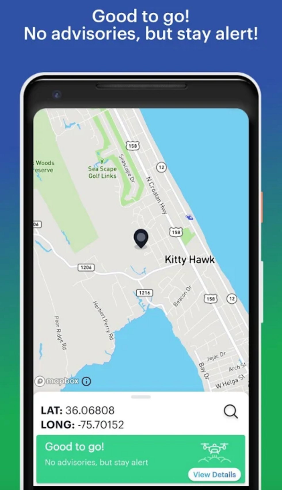
To illustrate the problem, here are some specific examples of places I wanted to fly my drone around Oregon. In each case, the FAA’s B4YFLY app (powered by Kittyhawk) was telling me that I was “good to go” when I really wasn’t. I’ve also included whether other drone safety mapping services (DJI FlySafe and Airmap) thought that it was safe to fly there, along with what it took to figure out the actual rules:
City of Portland Public Parks
• FAA B4UFly App: Good to Go
• DJI FlySafe: No Advisories
• Airmap: No Advisories
• Searching portlandoregon.gov for "drone": No info
• Searching portlandoregon.gov for regulations that include the word "aircraft" and then reading through them for something that might apply to drones: Prohibited
Oregon State Parks
• FAA B4UFly App: Good to Go
• DJI FlySafe: No Advisories
• Airmap: No Advisories
• Searching oregonstateparks.org for "drone": No info
• Interview with Oregon Parks and Recreation Department director from 2017 where she says they’re working on a three-tier approach to drone use that will be published online, and then searching for that: No info
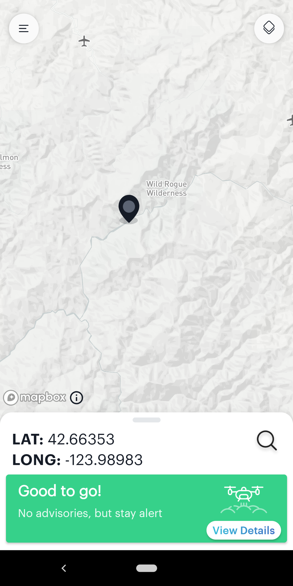 B4UFLY app showing “Good to go” over the Rogue River wilderness area.Image: FAA B4UFLY app
Rogue River (Wilderness Area)
• FAA B4UFly App: Good to Go
• DJI FlySafe: No Advisories
• Airmap: Prohibited
• Searching fs.fed.us for "wilderness drone": Prohibited
Rogue River (Wild and Scenic Area)
• FAA B4UFly App: Good to Go
• DJI FlySafe: No Advisories
• Airmap: No Advisories
• Searching fs.fed.us for "wild and scenic drone": No info
• Searching rivers.gov for "drone": No info
• Huron-Manistee National Forest (in Michigan) press release that I found on Google that seems to apply to all Wild and Scenic Rivers: Prohibited
The issue here is that for all of these places, the FAA’s B4UFLY app shows you a friendly green “good to go” message when in reality, flying in any of these areas is either explicitly prohibited or would require explicit permission. You could argue that this is worse than no app at all, because the app is actively giving you bad information. You are not, in fact, good to go, and if you’re already going, you should stop immediately.
We asked the FAA for comment on this, and the agency sent us the following statement:
The B4UFLY app provides information regarding airspace access for recreational drone flyers. It provides land use information for take offs and landings for National Park Service lands, but it does not provide information regarding take offs and landings are allowed on other federal, state, and locally managed lands and parks. Operators are expected to make themselves aware of any additional land use or police restrictions that may exist in the area where they wish to fly.
What the FAA is saying, I think, is that the B4UFLY app provides information about airspace, which is all that the FAA is allowed to regulate. The FAA can’t regulate anything on the ground, which is where most other drone regulations come in—when a city or state says “you can’t fly drones here,” what they’re actually saying is, “you can’t take off or land a drone from here because we own this land.”
However, I have two issues with this. The first issue is that the FAA threw National Parks Service lands into the B4UFLY app, which (as they say in their comment above) is explicitly about “land use” regulations, not something the FAA has jurisdiction over, as far as I know. In fact, the National Parks Service itself acknowledges that it’s not technically illegal to fly drones over national parks, as long as you launch, operate, and land from outside the park boundary. So, if the FAA is able to add national parks restrictions to the B4UFLY app, why not wilderness areas and other federal lands?
The second issue here is a much more fundamental one—recreational drone pilots put their trust in the FAA to tell them where they can and cannot fly. When the FAA itself presents the B4UFLY app as a tool that can be used so that “recreational flyers know whether it is safe to fly their drone,” that’s exactly what it should do. Instead, the app provides only one very limited kind of information about recreational drone safety, without telling the user that it’s on them to somehow dig up all the rest of the information that may or may not affect their flight. And based on my experience in Oregon, it can be a frustrating process that’s frequently inconclusive.
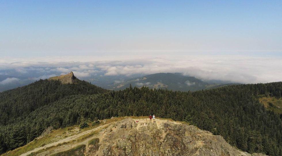 Taken by a Parrot Anafi drone in Gifford Pinchot National Forest.Photo: Evan Ackerman
In general, there’s a difference between not being prohibited from flying somewhere, and having explicit permission to fly somewhere, and I feel like responsible drone owners should always try and obtain explicit permission to fly. By “explicit permission,” I mean something somewhere that says, “the folks in charge of this area say that it’s okay for you to fly here.” This may be inconvenient, but it’s the best way of making sure that what you’re doing is safe and respectful.
Drones are so cheap and pervasive now that the only way to make sure that people fly them safely is to make the rules clear, concise, and easy to follow. The FAA seems to be trying to do this, but it’s simply not good enough. At the absolute minimum, the B4UFLY app should not tell users that they’re “good to go” unless they are flying from an area where drone use is explicitly permitted, like national forests. Anywhere else, users should be instructed to verify that their local laws allow drone use. Is that going to be a huge annoyance that drives users away from the app? Of course. But it’s the truth, and if the FAA doesn’t like that, they should work with local governments to put the necessary information into the app instead.
A version of this post appears in the October 2019 print magazine as “Drone Pilots Beware.”


