
It’s launch day for NASA’s latest mission, code-named Olympex, and the weather is soggy—a drenching rain with high winds expected. While technicians secure the payload and scientists guard their instruments, researcher Matt Wingo is keeping an eye on the forecast. “Perfect,” he murmurs.
Without so much as a countdown, this NASA mission gets under way. There’s no need for us to stand back, insert earplugs, or avert our eyes. Olympex’s maximum velocity will never break 5 kilometers per hour. The only real risk is that of stepping in the wrong place. That’s because this state-of-the-art weather and climate experiment is being launched by mule.
Pack animals might seem an odd choice for an agency known for rockets, rovers, and solar-powered ion drives. But where this team is headed—a remote location deep in the mountains of Olympic National Park in Washington state—there are no roads, no landing pads, and precious little sunshine. Indeed, the park’s rain forest is the wettest place in the continental United States. Which is precisely why the NASA team is here: to improve the accuracy of the newest rain-tracking satellite by vetting its results in the most sodden conditions imaginable.
NASA has always had as much interest in our own planet as it does in Mars, Pluto, or planets orbiting distant stars. The agency currently peers down at Earth from 17 satellites and the International Space Station, investigating things like polar ice sheets, ocean currents, and moisture in plant roots. [pdf] Many of the satellites have a connection with weather and climate, but only one, called Global Precipitation Measurement (GPM), is focused entirely on snow and rain. Olympex is designed to help researchers determine to what extent the satellite’s data agree with actual conditions on the ground.
The endless cycle of precipitation and evaporation is the most important meteorological process of our world. Every drop we drink, every crop we grow, and almost everything we make relies on water that fell as rain or snow. Societies can flourish or perish according to the vagaries of rainfall, and that’s never been more true than it is today, when humanity controls and consumes well over half the accessible freshwater in all the world’s rivers and lakes.
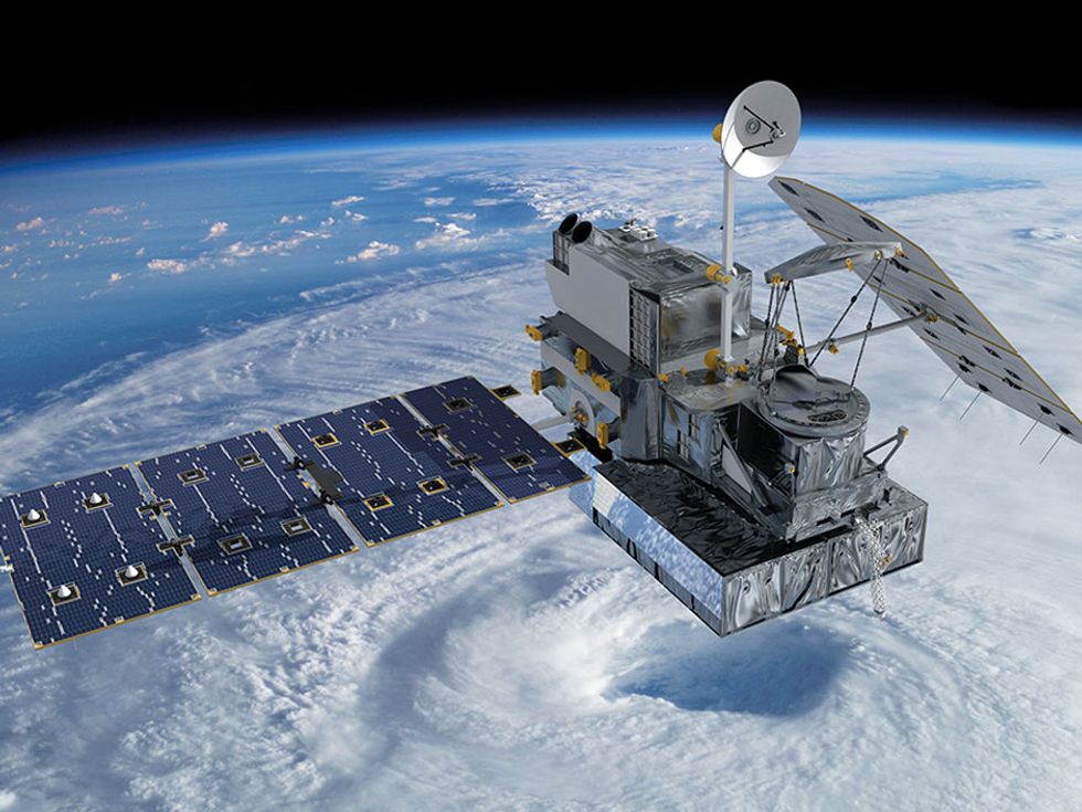
Launched in February 2014 by NASA and the Japan Aerospace Exploration Agency, the Global Precipitation Measurement (GPM) Core, is designed to measure precipitation worldwide.

Critical though it is, precipitation is still poorly understood, says Lynn McMurdie, as we dodge puddles on the trail. McMurdie is a meteorologist at the University of Washington, in Seattle, and she designed several experiments for Olympex (short for Olympic Mountains Experiment).
“Take the transition of rain from water to land,” says McMurdie from beneath her bright blue rain hood. “We don’t really know why one storm rolling in from the ocean produces five times as much rain over the mountains as compared to the coast, while another might not.” The GPM mission should help elucidate exactly that kind of mystery. McMurdie expects Olympex to see plenty of rain and snow, of course. Even more important, she says, “the storms we see offshore and in the Olympics are representative of storms worldwide. What we learn here will apply to a big part of the globe—parts of South America and North America, Europe, the southern parts of Africa, parts of Australia, and all of the ocean.”
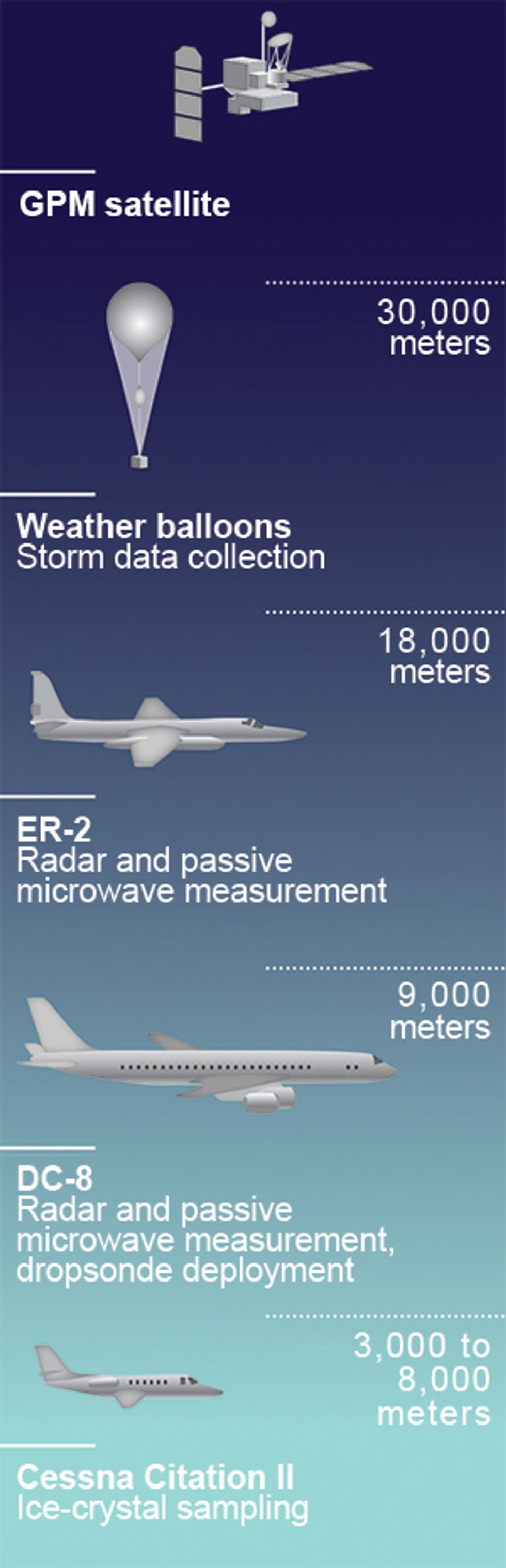 Sky View: Olympex ground observations are complemented by measurements at different altitudes. Researchers timed the aircraft’s flight paths to coincide with flyovers of the GPM satellite.Illustration: Emily Cooper
Accurately measuring our planet’s precipitation is tricky. Land-based instruments like rain gauges are useful, but their data are inherently local, small-scale, and exclude the 70 percent of the Earth’s surface that is covered in water. Satellites are the obvious solution for capturing a complete picture. Much of what atmospheric scientists know about rain they learned using TRMM, the Tropical Rainfall Measuring Mission satellite, launched by NASA and the Japanese space agency, JAXA, in 1997.
TRMM carried the first space-based precipitation radar, capable of delivering three-dimensional views of storms. The satellite also observed precipitation in the visual, microwave, and infrared bands, which provided a way to estimate the heat released by tropical rainfall. That heat is a crucial by-product of evaporation and precipitation: Energy from the sun converts surface ocean water into vapor; the stored energy in the water vapor then gets dumped back into the atmosphere when the vapor later condenses into clouds and rain. According to NASA, the heat released during tropical rainfall accounts for about three-quarters of the energy that drives atmospheric circulation. By carefully measuring the tiny amounts of microwave energy emitted by Earth and its atmosphere, TRMM quantified the rainfall intensity below.
Although TRMM was designed to operate for just three years, it sent back data for 17. The vast trove of information improved climate models and helped weather forecasters understand and predict tropical cyclones, floods, and landslides. But TRMM’s coverage extended only to 35 degrees latitude north and south of the equator, so the satellite could say nothing about precipitation in temperate climates and, in particular, nothing about snow. Many regions, such as Southern California, rely on snow falling on mountains in the winter to sustain thirsty farms and cities during the summer. Scientists and government officials desperately want to know how much snow falls in a given season and understand how that snowfall might change as the climate warms one or two degrees this century.
And so another NASA–JAXA collaboration, GPM, was born. The GPM Core satellite, which launched in February 2014, swoops between the Arctic and Antarctic Circles, covering nearly every sizable community on the globe.
On board are two key instruments. The GPM Microwave Imager is a radiometer that continues TRMM’s work in monitoring the energy released by storms, with the major addition of four new millimeter-wave channels that are particularly sensitive to snowfall. Meanwhile, the Dual-Frequency Precipitation Radar scans in the Ku band (14 gigahertz), as TRMM did, to measure heavy precipitation in 3-D. But this instrument also has a Ka-band (35-GHz) scanner, to better capture snow. When the data are combined, the Ku- and Ka-band radars yield more-accurate measurements of raindrop size and the altitude at which rainfall begins.
Local To Global:
The Olympex project’s weather-monitoring sites are scattered across Washington’s Olympic Peninsula. Storms seen offshore and in the mountains here are representative of storms worldwide.
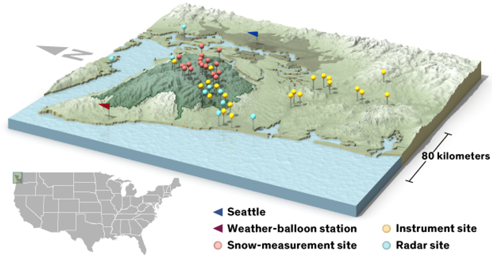 Illustration: Emily Cooper
Deploying a brand new platform in space involves more than just launching it into orbit. Scientists believe they know what the signals in GPM’s frequency bands mean, but there is always the chance that the natural world does not work in the way they expect. For example, if they mistake heavy rain for light rain, rain for snow, or hail for sleet, their weather forecasts and climate models will produce erroneous results.
Such errors could even propagate around the world. The GPM Core satellite is intended to establish reference standards for precipitation measurements from space. It’s also the centerpiece of an international constellation of satellites measuring microwave radiation, including spacecraft launched by France, Japan, India, the U.S. Defense Department, and the European Space Agency. NASA also hopes to lure Brazil, China, and Russia into this global rainfall measurement program.
But the only way to test whether GPM is really delivering the goods is to compare the images that scientists are seeing from space with rain and snowfall observed at ground level. And the best place to do that is somewhere that regularly receives 4 meters or more of rain a year: the rain forests of the Olympic Peninsula.
Enter the mules. Expertly roped into a train by their wrangler, Jill Michalak, who in her baseball cap and slick red rain gear doesn’t quite fit the image of a cowgirl, the dozen mules haul their cargo of delicate meteorological equipment with admirable fortitude. The rain runs off their backs as easily as from our Gore-Tex jackets. Only a whiff of food—or a bear, Michalak tells us—will stop them once they’re moving. On this early October day, plodding up the rocky, muddy trail in silence, the animals set a pace that soon leaves us human hikers behind.
For the rest of the fall and through the winter, the Olympex experiment will synchronize GPM flyovers with a far-flung suite of instruments on the ground and in the sky as well. This US $4.1 million “ground” campaign actually reaches up to the edge of space, where a Lockheed ER-2 jet flying at 18,000 meters will conduct radar and passive microwave measurements of incoming storms. The pilot of the ER-2—which is the civilian research version of a U-2 spy plane—even gets to wear a spacesuit.
Below the ER-2 but still far above the storms, a DC-8 will also take radar and microwave readings and deploy expendable dropsondes—30-centimeter-long devices that measure humidity, temperature, and wind as they drift down to Earth by parachute.
Meanwhile, a Cessna Citation II jet operated by the University of North Dakota for atmospheric research will collect data from within the storms themselves, conducting elaborate spiral maneuvers 3,000 to 8,000 meters above the ground and sampling ice crystals as they form. Scientists will also release weather balloons to rise through passing storms.
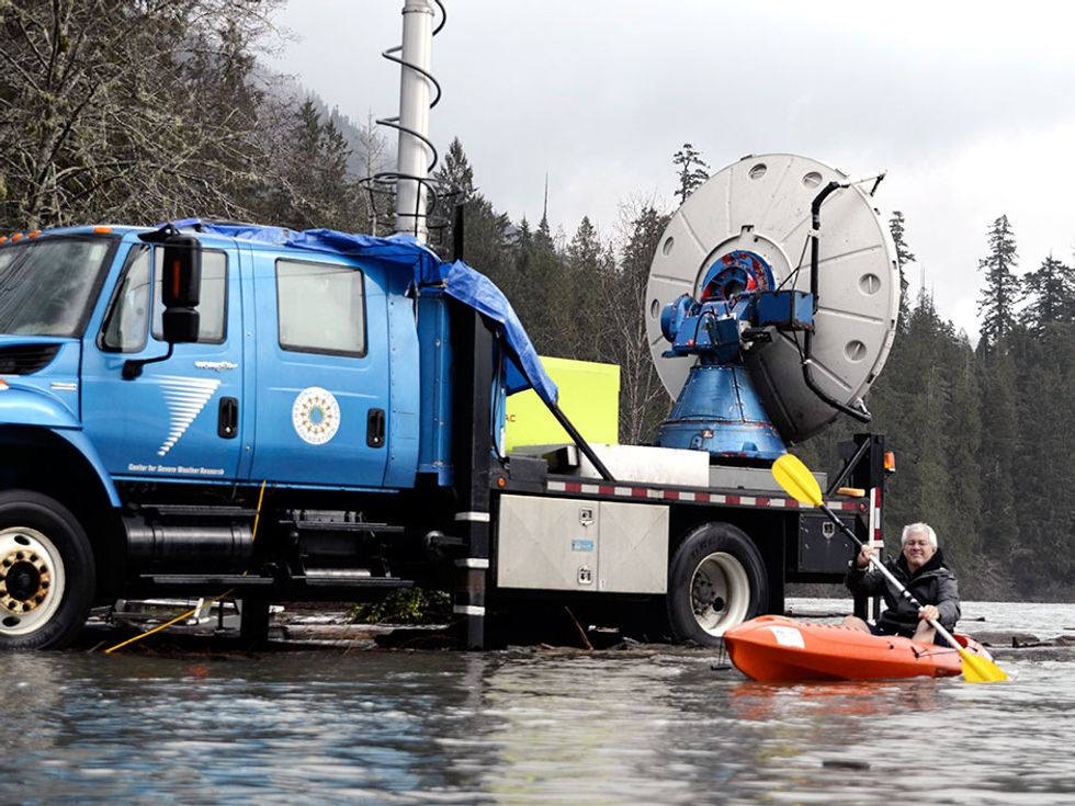
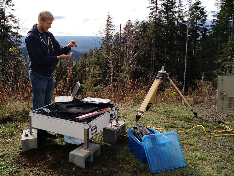
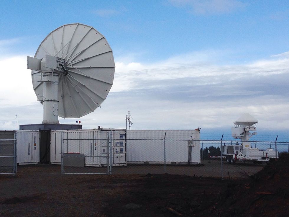
On terra firma, meanwhile, four radar stations mounted on trailers and four micro rain radars will scan incoming storms from all angles. Together, these stations will measure in the same frequency bands as the GPM satellite and additional bands as well. The NASA S-band polarimetric radar and Dual-Frequency Dual-Polarimetric Doppler Radar (known as NPOL and D3R, respectively) will collect detailed observations from the coastline of the Olympic Peninsula looking over the ocean and up the Quinault River valley. A mobile Doppler radar unit will also be stationed on the far shore of Lake Quinault, at the southwest corner of Olympic National Park. Finally, instruments will measure local conditions at a couple of dozen sites around the peninsula, from sea level to high above the snowline.
Some of these sites will do little more than collect rain in buckets and measure snow depth with cameras. Others will be much more sophisticated. At four locations, an instrument called a two-dimensional video disdrometer will measure raindrops using a pair of video cameras mounted orthogonally to each other and offset by about 6 millimeters, each with a halogen backlight. Every drop of rain that falls in front of the cameras is imaged. “Smaller drops are spherical, as you might expect,” says Wingo, a weather instrumentation specialist based at NASA’s Wallops Flight Facility, in Virginia. “But larger ones, 6 or 8 millimeters in diameter, actually look like the top of a hamburger bun.”
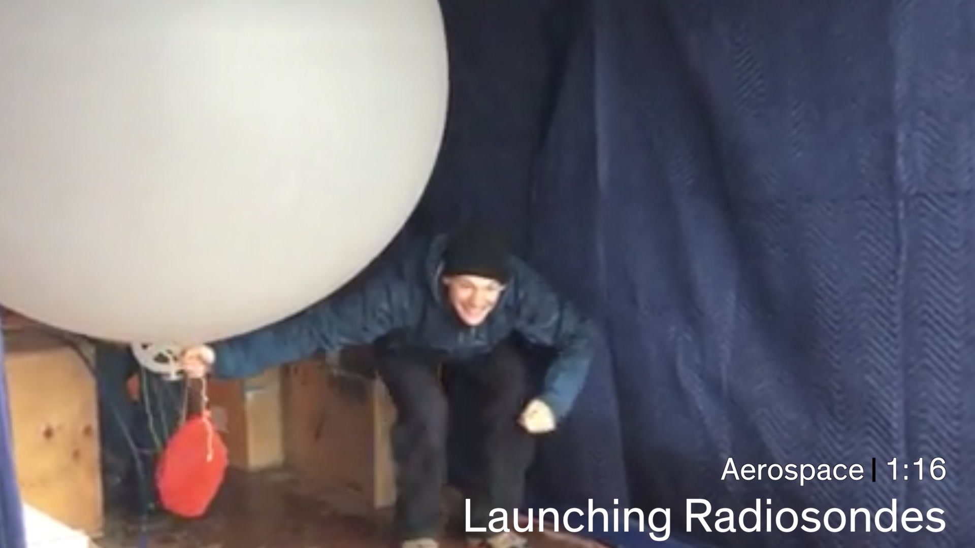
Video: NASA Goddard
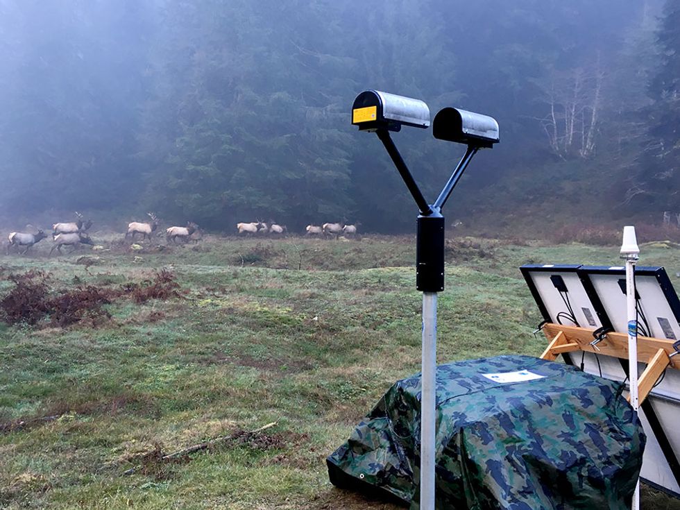
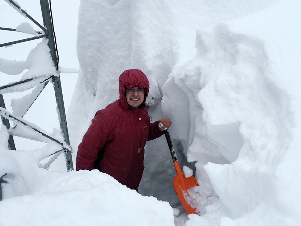
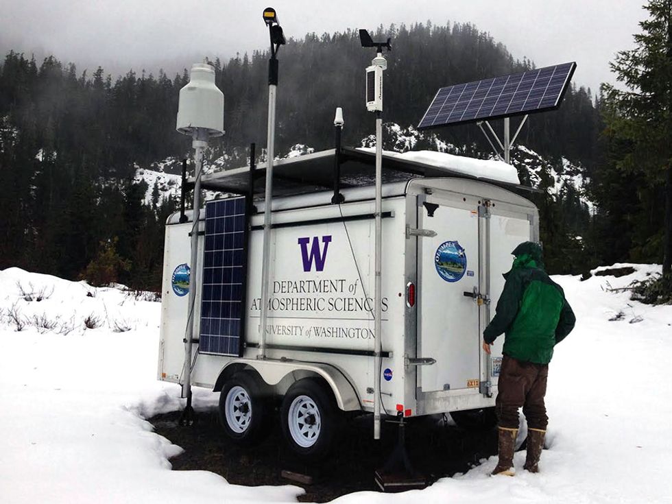
With its powerful halogen lamps, video cameras, and four onboard computers, the video disdrometer requires grid electricity to operate. But the remote site where the mules are headed is far from the grid. Their destination sits at the end of 21 km of boggy trail, in the mountains of the upper Quinault River valley. There, as the craggy peaks claw precipitation out of the warm, wet Pacific air, winter rain should transition to snow. The instruments being installed there will have to be self-sufficient for weeks or even months at a time, relying on batteries charged by solar panels.
The key piece of equipment for this site is a battery-powered Parsivel disdrometer. Instead of using power-hungry cameras, it measures the size, reflectivity, and velocity of every drop that passes through it with an efficient solid-state infrared laser. Even though it doesn’t image each drop, the data it does collect are enough for scientists to determine whether they’re measuring rain, sleet, or snow, as well as the precipitation rate and the drop size distribution. The little remote station also has a Pluvio precipitation gauge—a high-resolution electronic weighing system that calculates the amount of rain or snow falling in 1-minute intervals.
If all goes well, the instruments will remain in the mountains all winter, with just an occasional visit from grad student Joe Zagrodnik and park rangers CJ Urnes and Bill Baccus. Their job will be to download the data onto a thumb drive and empty the Pluvio’s rain collector and of course deal with any surprises. “Last year we did a sample run with instruments fitted with cellular wireless data links,” McMurdie tells me. “They all stopped working. The batteries died, moisture got inside, we couldn’t get a signal, and communications went down.”
This year, the remote ground stations have Iridium satellite modems that will phone home if anything stops working. “Maybe an elk comes and rubs up against an instrument,” says Wingo, with the anxious air of someone who has had to anticipate the worst-case scenario. “Or maybe a bear sniffs around the boxes. Or a pack rat gets in there and chews up a wire. We have redundancy to some extent…but I didn’t bring any spare instruments.”
Frankly, Wingo says, he would rather have used a helicopter to haul the instruments. But the location selected by the Olympex team, high on the windward side of the Olympic range, falls smack in the middle of a designated wilderness area. Here, motorized vehicles are allowed only when there is absolutely no other option. So mules it is.
The researchers don’t want to publicize the actual experiment site, for fear that interlopers might interfere with the instruments over the winter. So McMurdie and I leave the rest of the team and the mules a few kilometers up the trail.
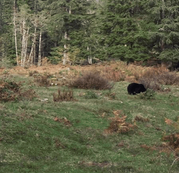 Passing Through: A bear visited one Olympex site.Photo: University of Washington
As I later learn, the group did in fact meet up with a large black bear grazing on a huckleberry bush. “It was clear that the bear was just going to mind its own business,” Zagrodnik told me later. “It looked at us and then resumed eating berries.” But the mules were spooked and required some coaxing to pass by. Later that night at camp, the bear reappeared. The lead mule, named Henry, “got loose and made a scene running around in circles” and bumping into things, says Zagrodnik. “We had already unloaded, so mostly it provided some humor watching the empty containers bounce around.” The rest of the trip, including installing and turning on the equipment, was uneventful.
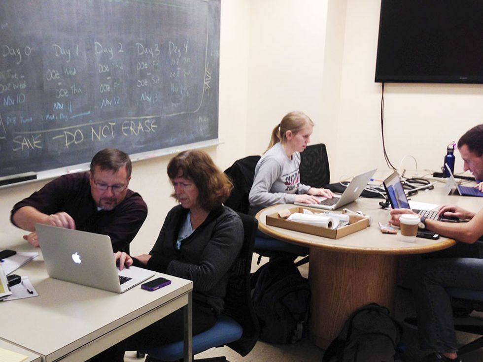
Several months after our soggy outing, I caught up with McMurdie at the university. Her team works out of the Olympex control room, which is basically a repurposed office. Here, dozens of scientists check in virtually or in person for daily updates on the instruments, the aircraft, and, most important, the forecast for the days ahead.
The weather couldn’t have been better—that is, worse—with several massive storms having barreled through the park, McMurdie tells me with obvious delight. During one 10-day stretch, a high-elevation station in the park recorded 104 cm of rain, more than Seattle gets all year. This inundation turned the Quinault trail into a river in some places. It also raised the level of the lake to the point where the axles of the mobile Doppler unit were underwater; scientists had to kayak in to do regular maintenance. During another heavy storm, a station at 610 meters recorded over 30 cm of rain, while one on the coast 10 km away saw less than 5 cm, she says. “That was an unusually big factor of difference. It’s clear that there’s no simple linear relationship between elevation, location, and rainfall.”
The biggest upset occurred during one of Zagrodnik’s maintenance trips, when another grad student slipped on a log and broke his leg. The injury was serious enough that evacuation by mule was out of the question—a helicopter had to be called in. There will be no similar rescue for the Olympex equipment at the end of the season. The winter’s exceptional storms have blown possibly hundreds of trees across the trail, even blocking the access road for 10 km leading to the trailhead.
“We can’t get mules up there until the trail is fixed, and they need mules to fix the trail. It’s going to take a while,” McMurdie says.
But the science continues. On one perfect day in early December, all three of the research aircraft flew into or over a heavy rainstorm as the GPM satellite passed overhead. “It was a fantastic data set, a miracle,” McMurdie exclaims. The aircraft wrapped up their nearly daily flights before Christmas, but the network of weather stations and rain gauges kept gathering deluges of data.
Indeed, the process of parsing the Olympex data—currently 17 terabytes’ worth and counting—and fully validating the GPM satellite is likely to take years, McMurdie says. “We’ve got a monumental task ahead to analyze the data.” But too much data, like too much rain, is a problem these scientists love to have.
This article appears in the June 2016 print issue as “Mules on a Mountain.”