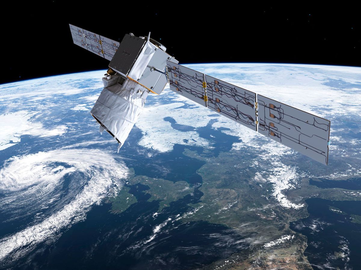
It’s closing time for one of Earth observation’s most stubborn and critical data gaps: global wind speeds. A European Space Agency (ESA) satellite set for launch from French Guiana tomorrow—after nearly two decades of challenging engineering and a weather delay—will be the first to directly measure wind speed and direction, from Earth’s surface to the stratosphere.
Winds are key determinants of weather and climate, yet most wind data still comes from weather balloons. Readings from commercial jets supplement the balloons’ twice-daily samplings, along with estimates inferred from satellites that track moving clouds, atmospheric temperatures, and sea-surface roughness. The result is a patchy wind record that adds uncertainty to weather forecasts.
The new satellite, named Aeolus, will improve on these measurements by deploying a wind-sensing lidar in space for the first time. It is essentially the same light-pulsing object-detection technology that helps police enforce speed limits and autonomous vehicles navigate roads. But instead of detecting motion by pinging a car with laser light and measuring the Doppler shift in the photons reflected back, Aeolus will ping molecules and aerosols in the air from 320 kilometers above Earth.
“It’s inherently difficult. The backscattered signal from the atmospheric constituents is quite weak, so you need a relatively large laser and a large telescope to gather enough photons,” explains Michael Hardesty, a lidar expert and senior research scientist at the Cooperative Institute for Research in Environmental Sciences, based in Boulder, Colo., a partnership of the University of Colorado and the National Oceanic and Atmospheric Administration. Hardesty serves on ESA’s mission advisory group for Aeolus.

The scientists working on Aeolus had to assemble their own ultraviolet laser because the existing ones had been built for nuclear weapon simulations and thus were classified. By 2005, they had a suitably powerful and stable laser that would pulse 50 times per second. With a telescope and dual receivers, the team could measure the laser’s reflection from atmospheric molecules (mainly nitrogen) or particles and, based on its frequency, discern average wind direction and speed.
Then a potential showstopper emerged when the team added mirrors and lenses and ran the device in a vacuum. The laser’s potent pulses heated the optical surfaces to 1,700 °C, damaging their coatings. And volatile organic compounds (VOCs) sucked from the instrument’s semiconductors by the vacuum formed a carbon layer on the lenses.
A decade passed as the Aeolus team developed robust coatings and a work-around for the soot buildup—adding an oxygen tank and continuously bleeding in trace amounts to burn away the VOCs in the lidar instrument. Finally, late last year, the scientists vacuum-tested the entire spaceship. In all, the extra work inflated the mission’s cost more than 50 percent, to an estimated €481 million (US $560 million).
Tomorrow's launch is supposed to place Aeolus in an inclined polar orbit, sending it up and around Earth about once every 90 minutes. As its lidar looks straight down at Earth, the satellite should produce a continuous ribbon of wind profiles starting 30 km above the planet and reaching down to the surface, or to clouds thick enough to attenuate its beam.
Aeolus’s data will most dramatically improve weather and climate science for areas with the sparsest wind measurements today, such as over oceans and the tropics. Experts anticipate significant improvement for Atlantic hurricane landfall predictions, and simulations suggest that it could improve the accuracy of typhoon path projections by 9 percent.
The ESA even expects the satellite to reveal some storms that would otherwise surprise forecasters. For example, in March 2014, a weather system flooded Northern Europe without warning because models could not see strong westerly winds blowing above the tropical Pacific.
Gil Lizcano, R&D director for the Barcelona-based meteorologic analytics firm Vortex, says the satellite’s data will also help tune algorithms to more accurately predict wind “ramp up” and “ramp down” events, which occur when winds quickly shift from low to high speeds, or vice versa. At present, such surges—and the corresponding rise or fall in output from wind turbines—force power plants to make last-minute adjustments that can be costly for both wind farm owners and grid operators.
Aeolus has enough fuel and oxygen to orbit for only three or four years, but a U.S. mission may follow, according to Gail Skofronick Jackson, a wind detection specialist at NASA’s headquarters in Washington, D.C. In January, a National Academies of Sciences report identified winds as a “high priority targeted observable,” notes Jackson. And hardware is already taking shape: NASA aircraft recently demonstrated a novel wind lidar developed by Hardesty’s team and Colorado-based Ball Aerospace.
This article appears in the September 2018 print issue as “Shining a Light on Global Winds.”

