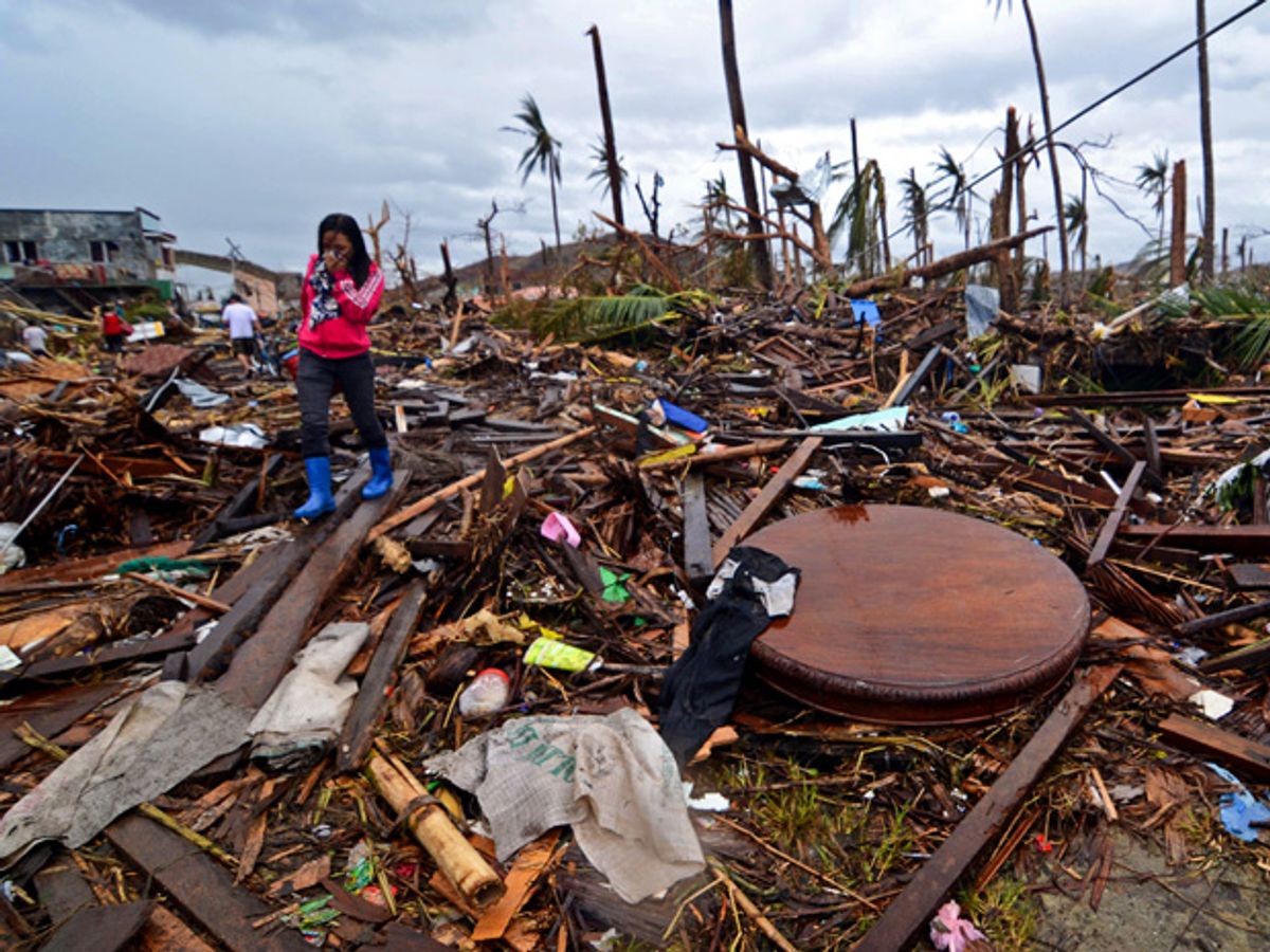
The typhoon that hit the Philippines last week killed thousands of people and displaced hundreds of thousands more, according to the BBC. The damage to infrastructure and the dislocation of all those people make it difficult for relief agencies to know where to route aid. Yet this typhoon, called Yolanda in the Philippines and Haiyan elsewhere, hit just as the technology to update maps and sift through social media is maturing. Filipinos and their faraway friends may be in the best position yet to respond to a typhoon, thanks to better digital coordination among volunteers.
Crowd-sourced crisis mapping dates back to at least the 2007-2008 Kenyan election violence. That prompted a group now called Ushahidi ("testimony" in Swahili) to build a platform for people to report violence through text messages or via the Web. The idea spread: The OpenStreetMap community responded to a 2009 cyclone in the Philippines, and again helped volunteers find their way around after the 2010 Haiti earthquake, says Kate Chapman, executive director of the Humanitarian OpenStreetMap Team (HOT) .
Those first attempts, however, did not make the best use of all the available volunteers. "We didn't have a way to coordinate it," Chapman recalls, "We just sort of said, 'Go map somewhere that's blank,' so you had to be a seasoned mapper to help." Since then, with funding from the Australian aid agency, HOT has developed an online task manager that allows even non-experts to chip in. "The difference is now we can say, 'Just log into the server and you can go through and it'll give you a square to work on,'" Chapman says. One volunteer has compiled just such a map, with updates to the Philippines OpenStreetMap; volunteers can now see where their work would be most useful. The latest iteration was built with input from over 600 volunteers who have contributed over 1.3 million updates.
Some of the work, done ahead of the typhoon's landfall, involved routine things such as tracing roads. But the group obtained its first post-disaster imagery, from a U.S. government agency, just today, says Chapman. Imagery from European agencies and other sources are also beginning to appear. "We can look at what roads are closed and where damage is worse," Chapman says. HOT has already sent PDF maps to volunteers and agencies such as the American Red Cross for printing before traveling to disconnected parts of the Philippines.
Volunteers can enrich maps with information from social media, too, reports IRIN. A Wall Street Journal article notes that doing so requires filtering through tens of thousands of tweets—a task that can be aided by software, but still requires many volunteers to verify information. Another disaster-recovery tool maturing now is Google's person finder, which it tested after the Japanese tsunami of 2011.
Readers interested in helping can consult the Digital Humanitarian Network for a list of participating groups. The Red Cross also has a recent big-picture look at the role technology plays in disaster relief.
Lucas Laursen is a journalist covering global development by way of science and technology with special interest in energy and agriculture. He has lived in and reported from the United States, United Kingdom, Switzerland, and Mexico.


