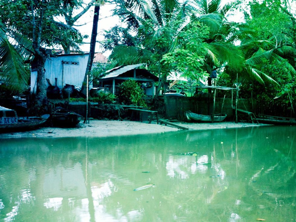
 More People: The Mekong Delta’s rivers, channels and canals are a developing and increasingly urbanized environment. The sensitive mangrove roots that line the banks—and slow floodwaters—are under threat, being cleared out for housing and more profitable aquaculture.Photo: Mike Dumiak
The Mekong River is a beast of burden, Vietnam’s great working water buffalo. It is filled with boats hauling fish, vegetables, wood, even iced coffee for sale in dense, floating markets. Houses everywhere perch on stilts over mangrove roots at its banks. These vital mangroves—which slow down fast-paced floodwaters and provide habitat—are being cleared in the southern delta for more profitable fish and shrimp farming. Away from the river’s shores, the land eases into slow wetland canals that border the rice paddies. This is a vast, green, drowned world—one increasingly filled with people. And that’s a problem.
Vietnamese researchers and urban planners have a new tool in their effort to figure out how all those people can live on the waterway. Six years in the making and part of an €11 million (US $15 million) project, the joint German-Vietnamese Wisdom information platform launched in 2013. Partner institutions in Germany and Vietnam combine top-notch, meter-wide-resolution images from the TerraSAR-X satellite with local sensor readings, databases, and archives featuring raw topographic and demographic data, along with the compiled scientific literature that makes use of this information. All that is fed into an online platform users can then search to find what they want.
The platform provides a detailed picture of how the delta is changing over time, says Claudia Künzer, the project leader and a remote sensing expert with Deutsches Zentrum für Luft- und Raumfahrt (DLR), the German space agency.
Trinh Thi Long, an ecologist at the Vietnamese Southern Institute of Water Resources Research, in Ho Chi Minh City, says he used Wisdom to gauge flood levels and sediment dynamics. “Infrastructure decisions to prevent future flooding in very specific areas will be influenced by these results,” he says. The data could also be used by agriculture officials to help rice farmers make better use of their sluice gates, which affect the inflow and outflow of sediment nutrients into their paddies. For the 18 million Vietnamese living in the delta, annual flooding is the major natural danger but also the lifeblood of their livelihood, turning the rice paddies emerald green.
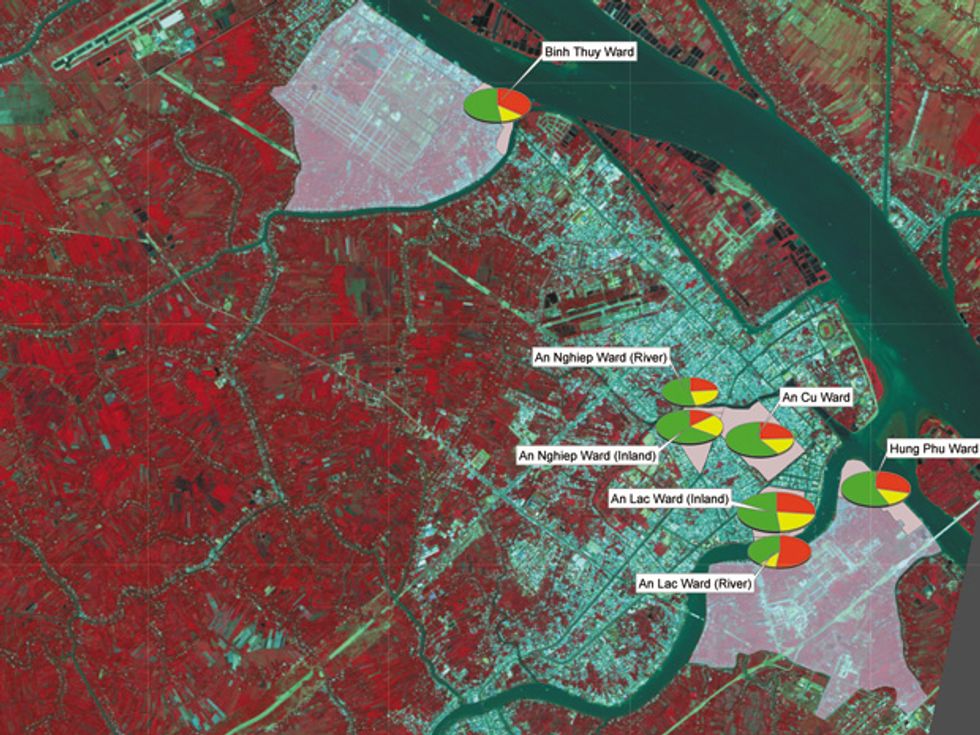 Winding Waterways: Images of the Mekong Delta from German satellites can be gathered by partner research institutions, built up with data from ground-based water and other sensors from science stations and fed into the WISDOM system.Image: DLR/WISDOM Project
It can be difficult for space-based sensors to pick up these water-inundated areas because of the matted green vegetation. Heavy cloud cover also obscures the delta during the flood season. An instrument on board the TerraSAR-X satellite—a microwave X-band synthetic aperture radar—clears things up by sensing the lack of diffuse reflections that flooded areas produce. Algorithmic tools and postprocessing sharpen the picture. The X-band images can then be combined with ground-based water-quality and water-level data, as well as other hydrological data from local sensor stations, geographic information system tools, and on-the-ground interviews and surveys. Thi Chinh Do did just that in his doctoral work on flood mapping, at the German Research Centre for Geosciences, in Potsdam.
His team mapped houses exposed to channel floodwaters, not just along the big Mekong riverbank but also scattered throughout Can Tho and its outskirts. Wisdom helped researchers spot households and businesses that could potentially be affected by flooding in areas that local officials may not have considered. Follow-up interviews in the neighborhoods and talks with rural-development and water-resources officials are starting to produce some possible solutions for local residents.
“Close earth observations show how the land cover is changing here,” the German space agency’s Künzer says. Using Wisdom, locals can gauge the level of pesticides and antibiotics in the delta water, see the impact of fish farming on the environment, and make decisions on how to cope with salinization due to rising sea levels. Other data, such as maps from the International Union for Conservation of Nature, may also be fed into the Wisdom platform.
So far, 34 doctoral candidates, half of them German, half of them Vietnamese, have been trained to use Wisdom. “We had over 100 trips, and experts trained local decision makers—basically, natural resources, agriculture, and environment district offices—on the system,” Künzer says. Vietnamese students with master’s degrees and an affinity for computers also learned to use it. This spring, the German space agency turned over the bilingual platform for the Vietnamese to manage.
Back up the river on a canal outside Can Tho, guide Nguyen Quyen—a young student and singer of Celine Dion songs—points to a yellow-flowered plane shrub. “These flowers show during the new year, during Tet,” she says. “More and more, they come out too early. Things are changing.” Now satellites can back her up on that point.
About the Author
Michael Dumiak is a freelance journalist based in Berlin who writes about technology and society. In the March 2013 issue of IEEE Spectrum he reported on Minsk’s surprising surfeit of artificial intelligence experts.